- Camp Cooking Supplies
- Camp Furniture
- Camping & Hiking Hydration
- Camping Beds & Sleeping
- Camping Equipment
- Camping Heating & Cooling
- Camping Lighting
- Camping Power & Solar
- Camping Toilets & Showers
- Electronics
- Gazebos – Awnings & Shades
- Health & Safety
- Packs & Bags
- Portable Fridges & Coolers
- Tents
- Pet Supplies
-80%


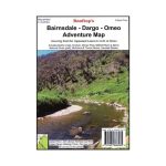
Rooftop Bairnsdale – Dargo – Omeo Map
Original price was: AUD$17.50.AUD$3.50Current price is: AUD$3.50.
Hurry up! Sale Ends in
Only 12 left in stock
84 people are viewing this right now
G****e purchased in Chicago,  United States bought this(10 Minutes ago)
United States bought this(10 Minutes ago)
Over 60 people have this in their carts right now
Description
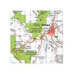
A double-sided map that includes Paynesville, Metung and Lakes Entrance in the south to Dinner Plain, Omeo and Mount Nugong in the north. It features Dargo, Mitchell River National Park, Swifts Creek, Cobungra, Victoria Falls, Cassilis, Deptford, Bullumwaal, Mount Baldhead, and Haunted Stream.
Bairnsdale Dargo Omeo Rooftop Map: coverage is from Paynesville, Metung and Lakes Entrance in the south to Dinner Plain, Omeo and Mount Nugong in the north. It includes Dargo, Mitchell River National Park, Swifts Creek, Cobungra, Victoria Falls, Cassilis, Deptford, Bullumwaal, Mount Baldhead, Haunted Stream and a huge amount of forest in between. A feature is the East Gippsland rail Trail which can be followed from Bairnsdale to Colquhoun, south-east of Bruthen.
Scale is 1:100,000. The reverse of the map has a 1:50,000 scale enlargement titled ‘Dargo – Swifts Creek Forest Activities Map’ with contours. All parks, reserves and state forests are shown and more than 6000 km of roads and tracks have been plotted using GPS mapping technology.
- Model / Product Code
- 9781921886065
- Material
- Paper
- Product Weight
- 9 g
- Warranty
- 12 months
- Primary Activity(s)
- 4WD & Offroad
- EAN
9781921886065
Reviews (0)


Reviews
There are no reviews yet.